
Hydrological Applications and Services, Water Survey of Canada, Environment Canada
Type of resources
Topics
Keywords
Contact for the resource
Provided by
Years
Formats
Representation types
Update frequencies
status
-
1. Provides public access to real-time instantatenous streamflow collected at over 1800 active locations in Canada. These data are collected under a national program jointly administered under federal-provincial and federal-territorial cost-sharing agreements; 2. Provides public access to archived daily streamflow for stations of interest using search criteria. These data include: daily and monthly mean, max and min of flow. For some sites, annual peaks and extremes are also recorded. Archived streamflow data are disseminated online; 3. Provides public access to a MS Access database file containing archived daily streamflow that users can download to their desktop. These data include: daily and monthly mean, max and min of flow. For some sites, annual peaks and extremes are also recorded. MS Access file is updated quarterly; 4. Provides public access to streamflow statistics for stations of interest using search criteria.
-
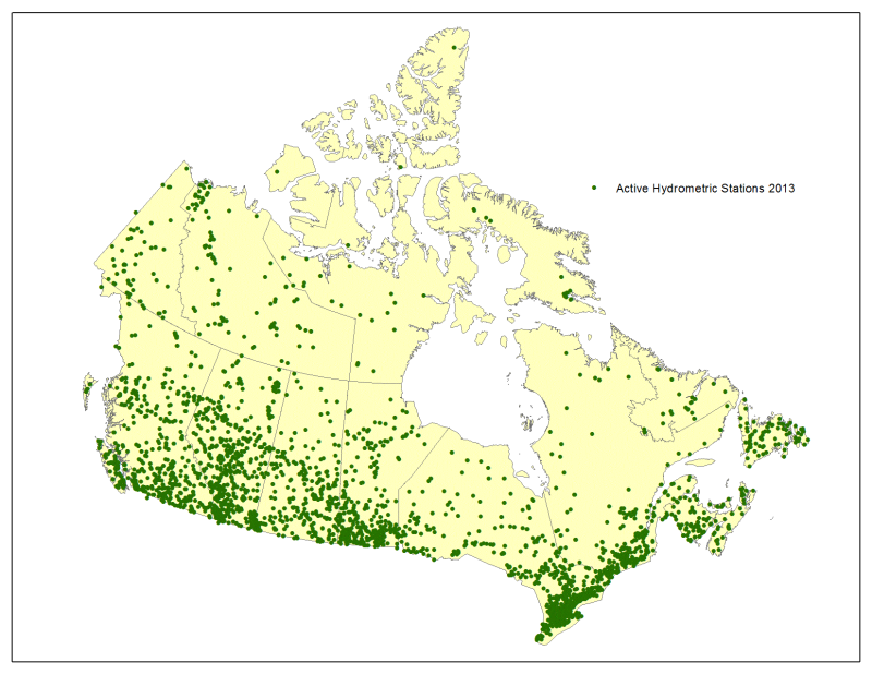
This site provides public access to real-time hydrometric data collected at over 1800 locations and access to historical data collected at over 7600 stations (active and discontinued) in Canada. These data are collected under a national program jointly administered under federal-provincial and federal-territorial cost-sharing agreements. It is through partnerships that the Water Survey of Canada program has built a standardized and credible environmental information base for Canada.
-
1. Provides public access to station metadata of hydrometric monitoring locations (active and discontinued); 2. Provides public access to the hydrometric station index listed in stream order beginning with the most upstream stations and extending to the most downstream stations.
-

Provides public access to archived sediment data (daily loads, daily concentration, instantaneous concentration) for stations of interest using search criteria. The sediment monitoring program discontinued in 1989. Archived sediment data are disseminated both online and offline via MS Access file.
-

1. Provides public access to real-time instantatenous water level collected at over 1800 active locations in Canada. These data are collected under a national program jointly administered under federal-provincial and federal-territorial cost-sharing agreements; 2. Provides public access to archived daily water level for stations of interest using search criteria. These data include: daily and monthly mean, max and min of water levels. For some sites, annual peaks and extremes are also recorded. Archived water level data are disseminated online; 3. Provides public access to a MS Access database file containing archived daily water level that users can download to their desktop. These data include: daily and monthly mean, max and min of water level. For some sites, annual peaks and extremes are also recorded. MS Access file is updated quarterly; 4. Provides public access to water level statistics for stations of interest using search criteria.